News
SWAT training course, December 1-3, 2016, Dakar, Senegal
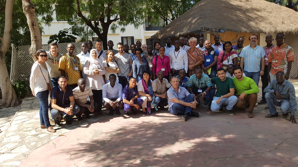
5 December 2016
From 1st to 3rd December 2016, a SWAT training course on “Initiation on SWAT model” has been delivered for 38 researchers, students and engineers at the UCAD-IRD Centre of Dakar-Hann (Dakar, Senegal) by José-Miguel Snchez-Pérez (CNRS, France) and Sabine Sauvage (CNRS, France) with the support of Didier Orange (IRD, France) and Amine Zettam (Université of Tlemcen, Algeria). This training course was coupled to the FRIEND-IAHS seminar (28th to 30th November at UCAD, Dakar), co-funding by PHI-UNESCO and IRD, with the key support from UCAD, EPS, OMVG.
During the SWAT training, 13 countries were represented, mainly from West Africa (Benin, Burkina, Ivory Coast, Niger and Senegal), Maghreb (Algeria, Morocco, Tunisia), Central Africa (Congo-Brazzaville, RCA and Zimbabwe) and Europe (Germany, France). This international cooperation South-South-North has addressed 11 River Basins from the whole African Continent, and has opened a large numbers of research opportunities on River Basin Management, Hydrology and Eco-hydrology.
PHOENIX Soil Carbon and Nitrogen Model
4 January 2016
Cesar Izaurralde, Bill McGill, and Jimmy Williams have incorporated the PHOENIX soil carbon and nitrogen model into APEX, giving users the option of choosing either the CENTURY or PHOENIX approaches to simulating soil carbon and nitrogen dynamics. For more information contact Dr. Williams (williams@brc.tamus.edu).
Plant Competition
28 December 2015
Cody Zilberberg, Jay Angerer, Lori Metz, and Jimmy Williams are working to introduce both interspecies plant competition and selective grazing into APEX. They are using modules for plant competition based on the ALMANAC model and the selective grazing component of PHYGROW. This development will allow APEX to realistically simulate grazing by and weight gain of cattle, sheep, and goats, as well as calving and weaning dates, rotational grazing, and methane emissions. For more information contact Dr. Williams (williams@brc.tamus.edu).
Wetlands
21 December 2015
Kate Behrman and Mari-Vaughn Johnson are working with Jimmy Williams to develop an improved wetland component for APEX. It is based on the denitrification subroutine developed by Cesar Izaurralde. Contact Dr. Behrman (kate.behrman@ars.usda.gov) for more information.
Bacteria
14 December 2015
Kyung Hwa Cho is interested in fecal bacteria dynamics in surface waters. Since existing watershed models have limitation in simulating seasonal variability of fecal bacteria, he has developed new bacteria subroutines for SWAT to improve its prediction accuracy. He is testing the new modules with observations from different sites. For more information contact Dr. Cho (khcho@unist.ac.kr).
New Landscape Contaminant Modeling System
7 December 2015
The US Army Corps of Engineers is developing a new landscape-scale contaminant modeling system to identify and simulate the fate of sediment, nutrients, and chemical contaminants over large spatial and temporal scales. The system uses:
- SWAT to simulate overland and small stream flows of water, sediment, nutrients and agricultural pesticides
- ATTIC (Advanced Tool for Tracking Industrial Chemicals) to identify commercial sources of specific chemicals of interest
- CSM (Contaminant Simulation Module) to simulate the transformation of contaminants in large streams
- NSM (Nutrient Simulation Module) to simulate algae, C, O, N, and P dynamics in large streams
- HEC-RAS (River Analysis System) to simulate flows and sediment transport in large streams.
The system is being tested in the Calleguas Creek Watershed in California. For more information contact Dr. Billy Johnson (Billy.E.Johnson@erdc.dren.mil).
Massive EPIC Analysis for the UK
30 November 2015
Robin Taylor is working with researchers at the University of Durham (UK) to use EPIC to conduct a massive factorial simulation experiment to determine if crop rotations can be used to reduce runoff, erosion, and nutrient losses from farm fields in the UK. The study involves 18 crops in 941 crop rotations grown on two sites, four slopes, eight soils, and 169 fertilizer combinations. The USDA-ARS computer cluster is being used, allowing 150 simultaneous runs to be executed simultaneously. To date, approximately 14 million runs have been completed, and about 8 million runs remain. For more information, contact Dr. Taylor (rtaylor@brc.tamus.edu).
Rice Paddies
23 November 2015
A group of SWAT developers, including Drs. Balaji Narasimhan (nbalaji.iitm@gmail.com), Phil Gassman (pwgassma@iastate.edu), Jaehak Jeong (jjeong@brc.tamus.edu), Tasuku Kato (taskkato@cc.tuat.ac.jp), recently met in Tokyo to discuss and plan improvements in simulation of rice paddy irrigation, hydrology, and water quality by SWAT and APEX. For more information contact these scientists.
Short-Term Weather Forecasts
16 November 2015
Hydrologic and agricultural management models can use short-term (1-8 days) weather forecasts in SWAT format to help farmers and water authorities manage their resources. Zach Easton (zeaston@vt.edu), Andrew Sommerlot (andrewrs@vt.edu) and Daniel Fuka are developing a tool based on the NCDC/NOAA Global Forecast System to allow SWAT to project hydrology up to eight days in the future. For more information contact Dr. Easton or Dr. Fuka.
Weather Data to Simulate Climate Change Scenarios
9 November 2015
Zach Easton (zeaston@vt.edu) and Daniel Fuka (drfuka@vt.edu), are developing a tool that allows users to generate daily IPCC CMIP-5 climate change data interpolated to the precise locations of historical meteorological stations. For more information contact Dr. Easton.